A meandering kind of day through Utah, Arizona and back to Utah
As of the end of today, 20 days into my trip, I have driven 5300 miles. That averages out to 265 miles per day (I'm a math teacher, deal with it). I have been up before dawn pretty much every day the past week so this morning I decided, to hell with hitting the road and sticking with a plan, I'm going to give my travel buddy an oil change and some slowing down time for myself. The only thing I HAD to do was to get to where I was staying for the night. I had to drive northeast to Blanding, Utah and let's see where the road takes me.

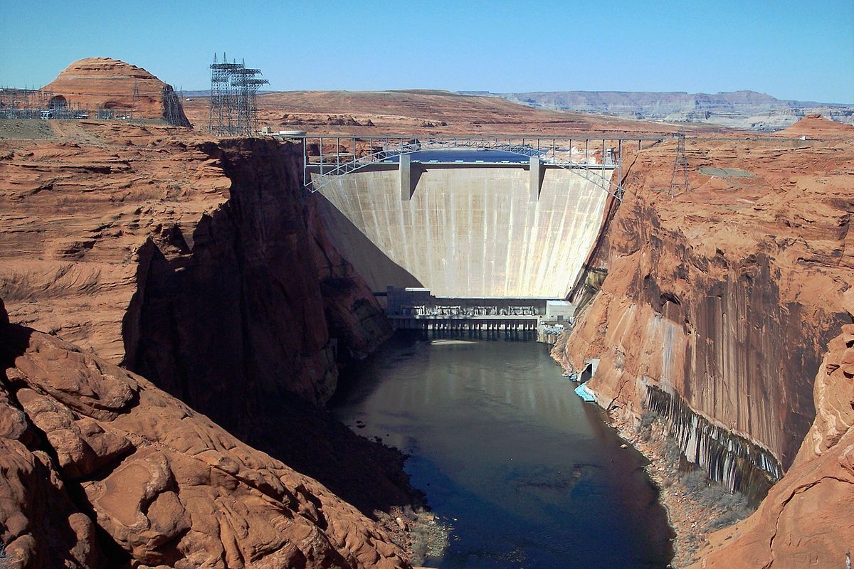


First I drove by Lake Powell, which is a reservoir on the Colorado River between Utah and Arizona. I guess it is a MAJOR vacation spot in the area. Here is the dam that created this lake. I took some pictures but they were through a chainlink fence so found one online.
Hopped back into my car and kept driving until I saw a sign for Horseshoe Bend in Page, Utah. Okay, sounds interesting. This is the first sign I saw. Great! :-/
The sign was correct! It was a really hot and sweaty sandy walk down to the bend but an even sweatier one back up the freakin' hill! It's about a mile each way but it was a cool thing to see.
There were so many people walking up and down that hill. I'd say there was a handful of Americans, another handful of Europeans (I heard French, German, Dutch) and a couple of handfuls of Hispanics. The overwhelming majority were mainland Chinese tourists there by bus. I know this because I asked. I got to say like 3 things in Mandarin and luckily found someone whose English was much better than my Mandarin.
This is the shot I took from the overlook. Pretty damned cool.
I kept driving and turned north on 160 in Navajo County. Another sign up ahead for Navajo National Monument. Okay, sounds cool! Drove about 10 miles off the main highway, not knowing what I was going to see. Stopped at the visitor center and was told to follow the path. Sounds good.
Another path DOWN a hill that I will then have to climb back up. Ahhh, the suffering I have to do for this adventure.
The plants along the way were amazing. So many twisted and gnarled trees including a pinion pine (on the right) which is where we get pine nuts. I didn't know they lived so high in elevation.
This is a yucca plant. I've never see one before.
Then I got to the reason I was taking this walk. This is a village built into the sandstone of a canyon. What?!! Cliff dwellers lived here between 1250-1300 AD.
I made my photo really huge so you can see the individual dwellings. Wow Wow Wow!

This is located in this canyon wall. Man, I love this stuff!!! What a wonderful surprise stop!
Once I made it back UP the hill, I saw this little gem.
After that amazing experience, I headed back to the highway and made a left onto 191 N to Blanding. I knew Monument Valley was on the way but decided I didn't have it in me to pay the price to drive through the Valley. Well, I didn't have to. Here are some photos I took along this INCREDIBLE drive!
The shot below was the last photo I took heading over a hill leaving the Valley. Holy smoke!!! What an extraordinary drive!!
I still had about 45 minutes to go and the view continued to be breathtaking. How much of this can a woman take?!
Oh wait, Mexican Hat! What's that? A right turn and this is what I get. Another find in the middle of nowhere.
The beauty continues as I drive through Bluff, Utah.
Even though it was supposed to be an easy day, I ended up driving 300 incredible miles and made it to the Navajo owned lodge in Blanding.
Home sweet home....for tonight anyway.


Comments
Post a Comment